08 Apr Synthetic Aperture Radar perspective for agriculture
Miloš Pandžić
Junior researcher, Institute BioSense
Remote Sensing (FR – télédétection; DE – Fernerkundung; SR – daljinska detekcija) is a technique of collecting the information about an object of interest or some phenomenon without a direct contact with it. It dates back with the invention of photography and the first areal images from balloons back in mid- 19th century. It developed a lot over this period, so nowadays there are various techniques for collecting the data about an object without touching it (multispectral cameras, RADAR, LiDAR, etc). All these techniques have in common that they use electromagnetic (EM) radiation as a mean of gathering the data.
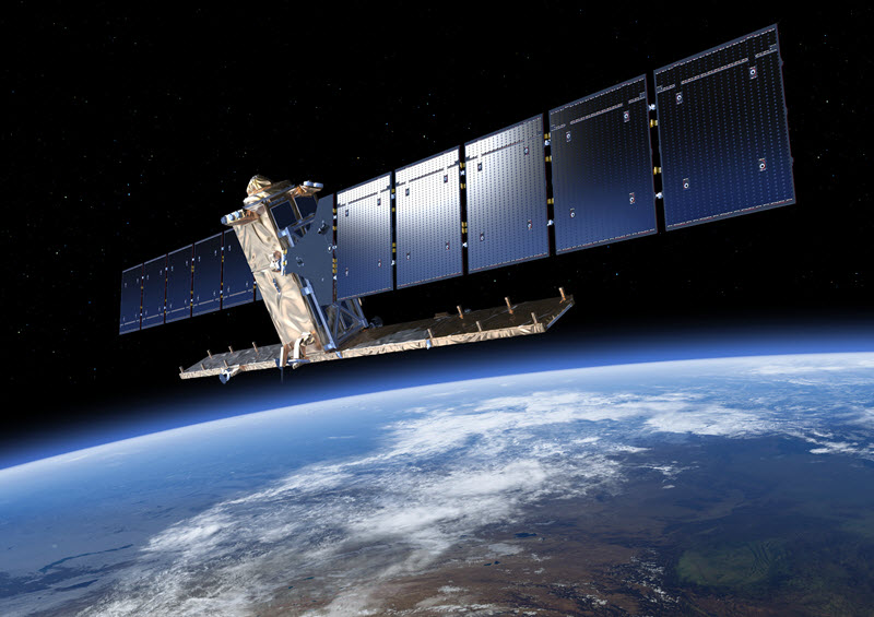
Synthetic Aperture Radar (SAR) is a specific technique because it uses microwave electromagnetic radiation. Depending on the part of EM spectrum which is used for sensing, e.g. in case of vegetation, it collects different information, whether about the vegetation canopy by reflecting the signal from canopy leaves or information about the inner structure by reflecting the signal from branches, stems or ground beneath the canopy. Yes, radar signal can penetrate the canopy depending on the wavelength of the signal!
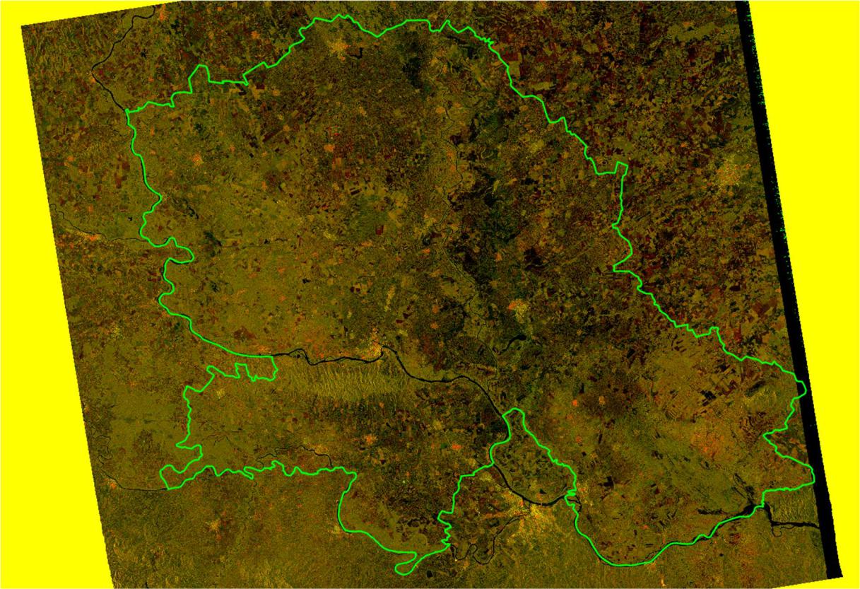
Figure 1. Sentinel-1 SAR image mosaic of Vojvodina, Serbia on 14/08/2017 (images processed in BioSense Institute)
SAR working principles also make it able to penetrate clouds, which is very useful in cases when opticalimagery is obscured by clouds. In principle, SAR has its own source of illumination which sets it in a group of active sensors and enables it to work both during day and at night. In this sense, SAR is actually very reliable source of information.
In agriculture, SAR is used for classification, monitoring vegetation dynamics, collecting the information about soil and vegetation characteristics (such as roughness and moisture), irrigation, and in many other applications. When performing crop classification, SAR can be utilized independently or in combination with optical images. Since SAR backscatter signal is influenced heavily by radar’s inner characteristics (e.g. frequency, incidence angle, polarization) as well as plants’ geometries (size, shape and orientation) and dielectric properties (plant water content), shown in Figure 2., information derived by SAR is different than the one derived from optical images. Thus, SAR brings added value to well established crop classification process using solely optical imagery. In one of the recent projects, where the aim was to perform early- and late-season crop classification in part of the Pannonian plain, researchers from BioSense Institute managed to, respectively, achieve 75% and 90% accuracy by using jointly SAR and optical imagery. These results were better than the crop classification accuracy achieved using single source data.
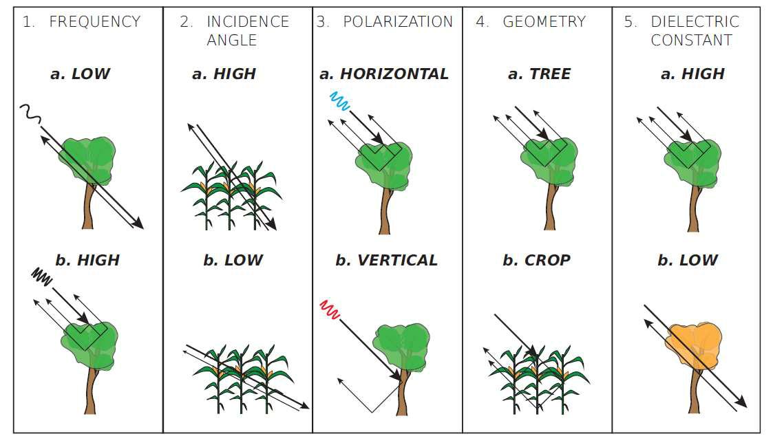
Figure 2. Schematic diagram of different influences on backscatter signal (van Emmerik, Tim. (2017). Water stress detection using radar.)
SAR image processing is more complex than of optical imagery because SAR images are not intuitive and receptive to human eye like optical ones. However, it is worth learning and understanding SAR technique because it provides unique information, highly valuable, that no other sensor is capable of.
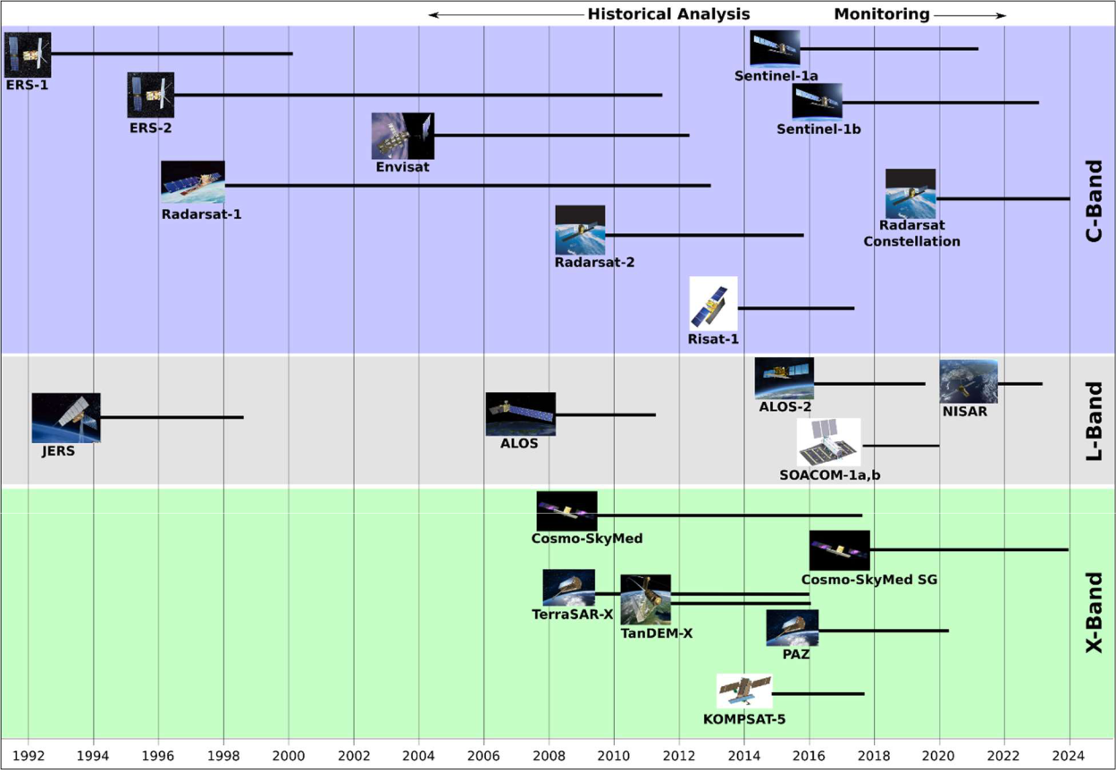
Figure 3. Historical review of SAR satellite missions
(https://www.unavco.org/instrumentation/geophysical/imaging/sar satellites/sar-satellites.html)
With recently available Sentinel-1 SAR data distributed free of charge by the European Space Agency,community interest in radars increased significantly because for the first time ever people are offeredwith high quality radar data at no cost for both scientific and commercial use. Figure 3 shows historical overview of SAR satellite missions. Apart from Sentinel-1, other modern SAR satellite missions are RADARSAT-2 and RADARSAT Constellation Mission by the Canadian Space Agency, TerraSAR-X and TanDEM-X by DLR and EADS Astrium, ALOS-2 by JAXA, Italian COSMO-SkyMED SG, Korean KOMPSAT-5,
ICEYE’s SAR microsatellites, etc.