06 Oct DETECTION OF IRRIGATED CROPLANDS FROM SATELLITE
Mirjana Radulović
Junior Researcher, BioSense Institute
As the world population is projected to reach 9.1 billion by 2050, agriculture productivity needs to increase, to meet the surging demand for food. Considering that, sustainable agriculture strategies must be developed. The major problem is more frequent serious hazards among droughts has been recognized as one of the most severe threats for agricultural production.
Since the water is most important for plant growth, the only way to overcome this challenging issue is through using irrigation supplies artificial water. Irrigation plays a key role when it comes to meeting the world’s food needs providing better crop growth conditions and higher average crop yields. Worldwide, irrigated agriculture now provides roughly 40% of total food production and consumes about 70% of freshwater withdrawals.
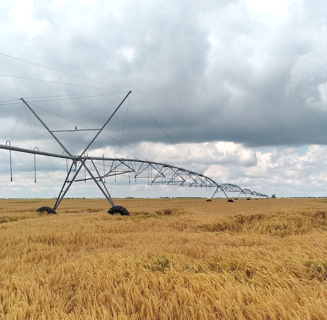
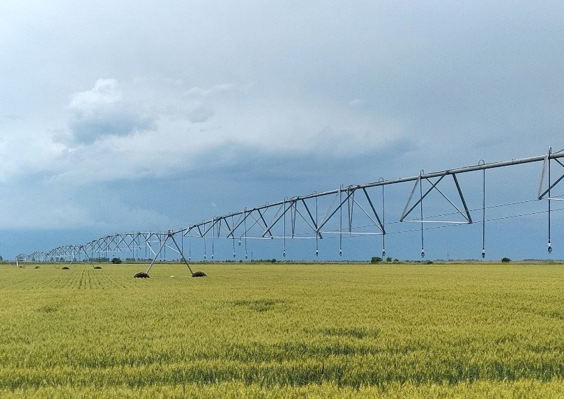
Figure 1. Linear irrigation system
Source: Author
Due to limited freshwater, a major challenge in the 21st century will be to meet increasing demands on agriculture for food caused by climate change and population growth. Exact information about the spatial distribution of irrigated croplands can contribute to solutions to this challenge. As well, this information is crucial if we want to understand how agriculture has an impact on water use. Тhis would improve efficient water management and recognizing irrigation water supply and demand under climate changing. Due to diverse crop types, wide climate impact, and different management practices, irrigated agriculture is a challenging land-use class for classifying. Despite the importance of irrigation for food security, the derivation of accurate information regarding the spatial extent and distribution on a national scale is relatively underdeveloped.
With the availability of remote sensing data which include global, near-real-time observations, consistent data records, and improved spatial resolution, this problem is overcome.
Detecting and monitoring irrigation cropland require remote sensing data in a high spectral and temporal resolution and Sentinel 2 has great potential in meeting these requirements. Providing the unique capability to map cropland extent using images at a resolution 10-60 m with the frequent coverage of 5 days, Sentinel 2 optical data has been using successfully to estimate different vegetation conditions interpreted in the form of vegetation parameters. Besides the frequent use of the Normalized Difference Vegetation Index (NDVI), researches explored the sensitivity of other vegetation indices on crop conditions. Thus, they found that indices derived from near-infrared (NIR) and short-wave infrared (SWIR) such as Normalized Difference Moisture Index (NDMI), Normalized Multi-band Drought index (NMDI), Moisture Stress Index (MSI), etc., can be used for soil moisture detection and they are more sensitive when it comes to drought stress detection. Besides remote sensing indices, climatic data such as precipitation and air temperature are also useful for differentiating irrigated from non-irrigated croplands. By utilizing these data as input for machine learning algorithms based on artificial intelligence, the most suitable model could be developed for deriving a map of irrigated croplands.
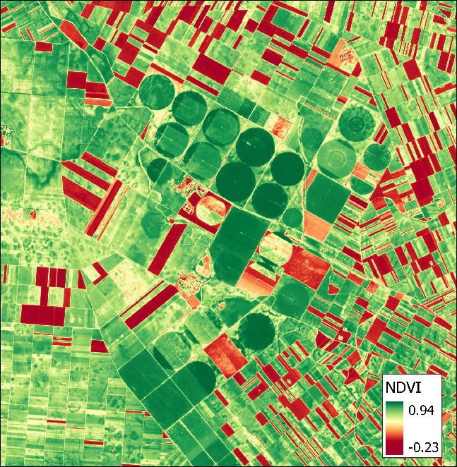
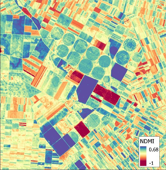
Figure 2. Vegetation indices derived from Sentinel 2 satellite
Source: images processed in BioSense Institute
As the water resources are becoming increasingly scarce, it is very important to make effort to improve the management of these natural resources in order to ensure the future protection and development of the agricultural sector.