10 Nov DETECTION OF ANOMALIES WITHIN AGRICULTURAL PLOTS USING SATELLITE IMAGES
Nina Pajević
Junior Researcher, BioSense Institute
Agricultural plots are subject to various negative influences that can lead to reduced yields. Some of the factors that affect the development of crops on the plot can be drought, floods and other weather disasters that affect the entire plot area, but also pests, diseases, as well as vitality and the germination potential of seeds that can affect only certain parts of the plot.
As agricultural plots are mostly large and inaccessible from the Earth’s surface without field passage through the whole plot, which is mostly impractical and very time consuming, detection of a problem if there are minor anomalies within the plot is a difficult task for farmers.
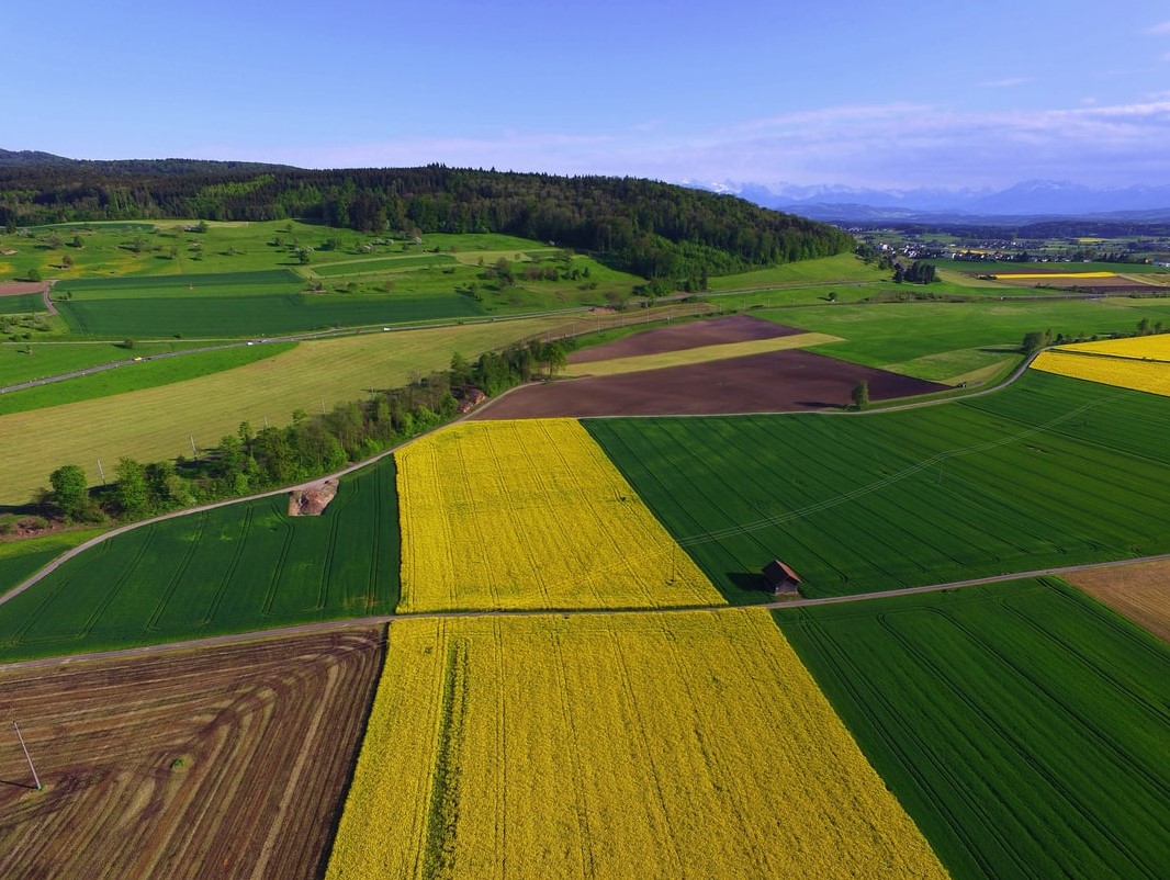
Advances in digital photography have made it possible to set up image acquisition systems on satellites in Earth’s orbit. By using satellite images for the purpose of monitoring the development and health of crops, it is possible to prevent and remedy some of the negative phenomena in a timely manner.
Sentinel-2 is a pair of satellites whose mission is to photograph the Earth’s surface in high resolution and in multiple spectral ranges, with a time period between two images of the same surface being 5 days. The satellite has an optical multispectral instrument (MSI) that measures solar radiation reflected from the Earth in 13 spectral bands including the visible, near-infrared, and short-wave infrared bands, of which 4 bands have a spatial resolution of 10 m, 6 bands have a resolution of 20 m, and 3 ranges resolution of 60 m.
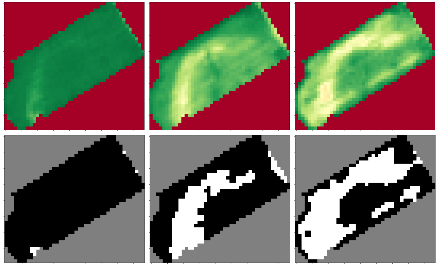
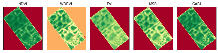
By combining different channels of the multispectral satellite image, vegetation indices are derived, which carry information about the general condition of the crops, but also about different physiological parameters of the plant such as plant health, amount of chlorophyll in the leaves, canopy surface, and plant moisture. The vegetation indices used in the study are NDVI (Normalized Difference Vegetation Index), WDRVI (Wide Dynamic Range Vegetation Index), EVI (Enhanced Vegetation Index), MSR (Modified Simple Ratio), and GARI (Green Atmospherically Resistant Vegetation Index). Unsupervised segmentation of Sentinel-2 satellite images is performed using machine learning and computer vision algorithms based on index images in order to map stress-affected regions of agricultural land that could lead to reduced yields.
enables remote monitoring of crops. Further work on the topic could rely on the proposed segmentation method to develop a system for classifying different types of anomalies that are of interest for a particular crop type, given that certain anomalies can represent a combination of different causes.