17 Nov Soil electromagnetic conductivity in precision agriculture
Dimitrije Stefanović
Junior Researcher, BioSense Institute
The most important tasks of precision agriculture are to reduce costs, maximize yields and reduce the harmful impact on the environment. Although the economic gains that farmers currently make by applying precision farming methods are noticeable, they need to be improved in order to popularize the practice of applying these methods among farmers. Cost-effective identification and management of spatial variability of soil and nutrients, variable fertilization, application of various agrotechnical measures depending on the production capacity of the plot, precise decision making using various indicators, are just some of the possible ways to improve these gains.
Farmers use a variety of information to make decisions, such as yield maps, laboratory tests of land, visible changes in soil appearance and topography. In addition to the above methods, measuring the electromagnetic conductivity of soil has long been used to identify soil properties. Given that soil is a medium for plant development, it is crucial to know all the details of a given medium and how its characteristics affect the growth and development of plants. Depending on the measured values of conductivity, it is possible to distinguish clay from silt or sandy soil, and they also correlate with the size of the soil grain and texture.
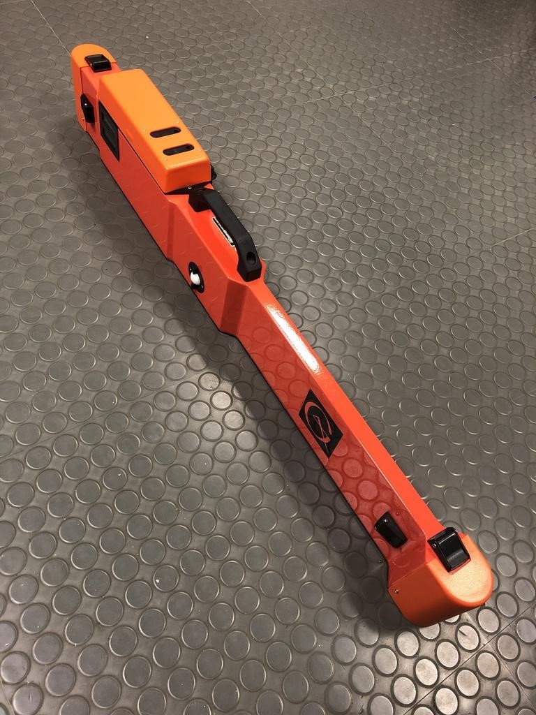
Figure 1. Geonics Ltd. EM38-MK2 probe
Instruments for measuring the electromagnetic conductivity of soil are also used to collect data as part of research conducted by researchers from the BioSense Institute. One such instrument is Geonics Ltd. EM38-MK2 probe. This instrument consists of 2 receiver coils at distances of 0.5 m and 1 m from the transmitter coil and they are used to simultaneously detect the values of apparent electrical conductivity as well as magnetic susceptibility at depths of 0.5 m and 1 m. By connecting to a precise GPS device, georeferenced data is obtained ready for further processing.
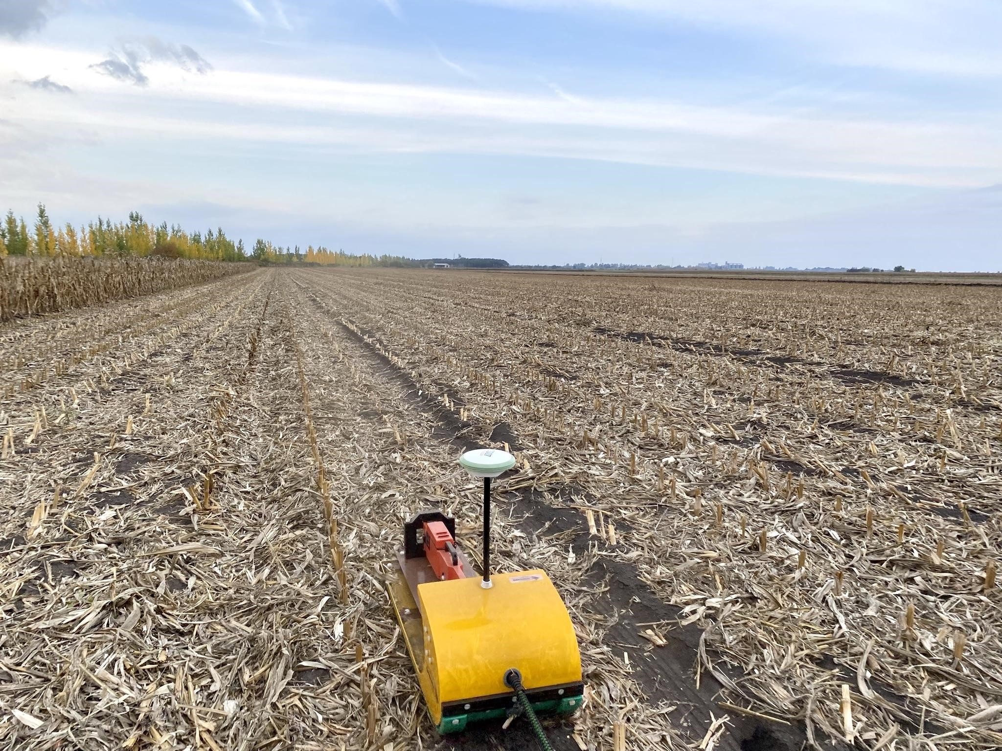
Figure 2. Geonics Ltd. EM38-MK2 probe in field conditions. The probe is placed in a special sledge
The data obtained in this way is used to get fast and reliable information on properties such as soil salinity. It also provides the ability to monitor crop water use and water available to plants in the soil profile during the growing season. In this way, precise and timely decisions on irrigation or fertilization can be made, which directly affects the future yield.
Sampling plays a very important role in soil testing, which is usually carried out at a large number of equidistant points within the plot. By processing the data obtained by the electromagnetic probe, maps with a certain number of zones can be generated that give us information on how to sample the soil in a smart way, which can reduce the cost of soil analysis for the whole plot.
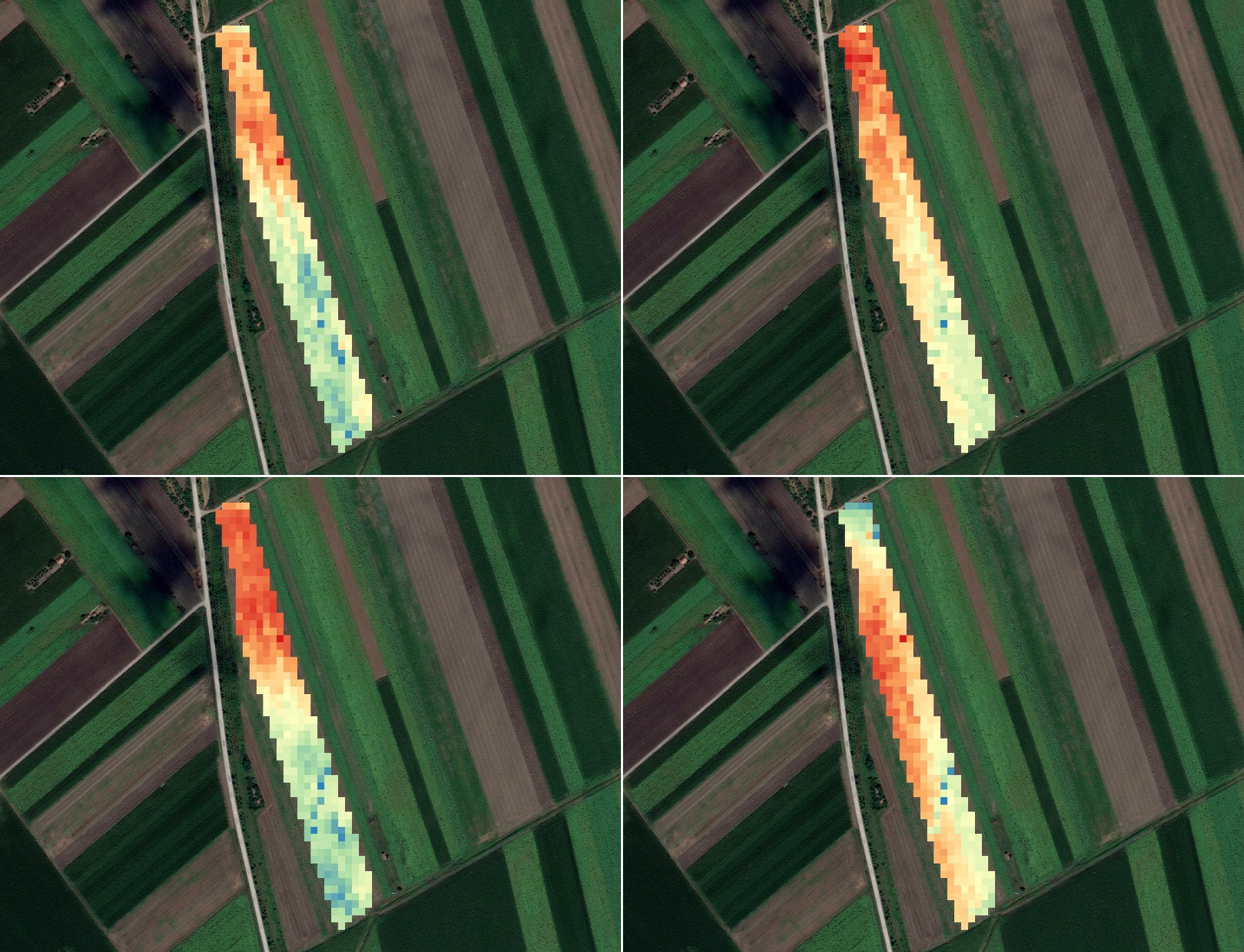
Figure 3. Soil electromagnetic conductivity maps obtained by interpolation: conductivity at 0.5 m (top left) and 1 m (bottom left), magnetic susceptibility at 0.5 m (top right) and 1 m (bottom right)